The stratospheric polar vortex is currently at record-strong levels, based on the metrics of 10 hPa 60°N zonal-mean zonal-wind and 60-90°N average temperature. This is likely to be due to a combination of the timing and duration of the major Sudden Stratospheric Warming (SSW) in January: the duration of easterlies (most of January) shielded the vortex from vertically propagating wave activity for an extended period (these waves cannot propagate into a layer of mean easterly flow) allowing the vortex to redevelop following the SSW, whilst the early-season timing allowed strong radiative recovery in the absence of significant solar radiation. The associated positive stratospheric NAM is well coupled to a positive tropospheric NAM, which seems also to have enhanced North Atlantic storminess. It’s all a far cry from where 2019 began.

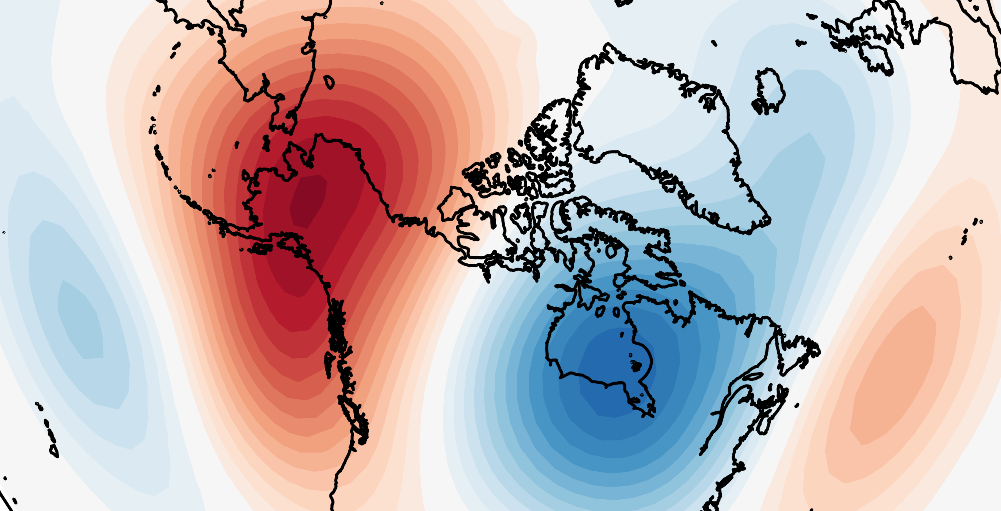
However, and not for the first time this winter, our attentions have turned to stratospheric warming! Recent forecasts from the GFS ensemble have shown a large pulse of wave activity with an amplification of the Aleutian ridge stretching and displacing the vortex. Stratospheric temperatures are expected to rise rapidly, and some ensemble members are suggesting [U] 10 hPa 60°N to turn easterly again in early April.
Record-strong #PolarVortex set to undergo significant weakening next 10 days with amplifying Aleutian ridge & vortex displacement towards Eurasia.
1 member of today’s 00Z GEFS reverses 10 hPa 60N zonal-mean zonal winds to easterly in next 16 days! pic.twitter.com/Qsjupq5VKf
— Simon Lee (@SimonLeeWx) March 14, 2019
So, a rapid rise in stratospheric temperatures, accompanied by a displacement of the polar vortex and a reversal of zonal winds… is this then another major Sudden Stratospheric Warming?
Yes and no.
The major SSWs we talk about are more technically “major midwinter warmings” (MMWs), which are followed by a recovery of the stratospheric Polar Vortex to westerlies for at least 10 consecutive days before April 30 (Charlton and Polvani, 2007). The upcoming warming event is likely to become what is known as a dynamic Final Stratospheric Warming (FSW), also known as a “major final sudden stratospheric warming (“major final warming”, MFW)” (Manney and Lawrence, 2016).
The “Final Warming” refers to the transition of the stratosphere to “summer mode” – when the polar vortex dissipates and easterlies develop which persist until late August/early September when the vortex reforms. This is most simply driven due to thermodynamics – a result of solar radiation returning and warming the polar region. Climatologically, the last day of zonal mean westerlies is April 12th.
However, sometimes a sudden warming driven by the same dynamical processes which cause MMWs can occur so late in the season that the vortex is unable to recover as the Sun returns to the pole. This then becomes a dynamic FSW.
There’s a couple of reasons why FSWs don’t get the same attention as MMWs. They are dynamically different in that the planetary wave behaviour following the event is different (since stratospheric easterlies remain). The late-season timing of the events means the typical cold-weather outbreaks don’t occur with quite such severity, and tropospheric responses are often lost in the seasonal transition (with tropospheric jet streams and storm tracks evolving from winter-mode to spring-mode). There’s also the consideration of the anomaly magnitude – stratospheric zonal winds are weak or easterly during April regardless of whether a dynamic FSW occurred, which is very different to mid-winter. But, largely, the differentiation is just based on statistics, and everything in the build-up and occurrence of the warming is the same – which makes them another source of information about the behaviour and predictability of the troposphere and stratosphere.
Some FSWs are rather special and are “SSWs in hiding”. March 5th 2016 saw a very strong stratospheric warming event which produced the second-strongest zonal-mean easterlies on record (at 10 hPa 60°N), but is often forgotten because it became an FSW [interestingly, the 2016 event also decelerated a record-strong vortex, like 2019 is expected to do…]. The oft-mentioned statistic of the February 2018 SSW being the first since January 2013 is indeed true, but it means the March 2016 event – which was an MMW in all but a technicality – is forgotten. There was some lively debate on Twitter recently as Judah Cohen argued the March 2016 event deserved to be included in the SSW Compendium! Indeed, it did have some significant surface impacts with downward propagation of a negative NAM phase into the troposphere. Britain saw a cold and snowy Easter that year, for example.


You have to draw the line somewhere. Maybe we should have a Final Stratospheric Warming Compendium so these events are given equal treatment.
Returning to 2019, given that we currently have a strongly zonal state, it will be interesting to see whether the upcoming warming event has an effect on that – though discerning any transitions from those which would occur simply because of the seasonal cycle may be more challenging. And, just like sudden warmings, we face the question of whether or not the troposphere is even all that bothered by the stratosphere!
References
Tripathi, O. P., A. Charlton-Perez, M. Sigmond, and F. Vitart, 2015: Enhanced long-range forecast skill in boreal winter following stratospheric strong vortex conditions. Environ. Res. Lett. http://doi.org/10.1088/1748-9326/10/10/104007
Charlton, A. J., and L. M. Polvani, 2007: A New Look at Stratospheric Sudden Warmings. Part I: Climatology and Modelling Benchmarks. J. Climate. http://doi.org/10.1175/JCLI3996.1
Manney, G. L., and Z. D. Lawrence, 2016: The major stratospheric final warming in 2016: dispersal of vortex air and termination of Arctic chemical ozone loss. Atmos. Chem. Phys. https://doi.org/10.5194/acp-16-15371-2016
